
Easily Make Topographic Maps in Photoshop and Illustrator
Vector Topographic Maps
You probably saw a few backgrounds (on posters, books and magazine covers, etc) using topographic maps to make a design more appealing. Those kind of maps can be made by hand, scanned and cleaned or more easily made combining Photoshop and Illustrator capabilities. So today, I will show you a quick and easy way to make topographic maps that you can use on any of your designs and at any size since the end result will be a vector.
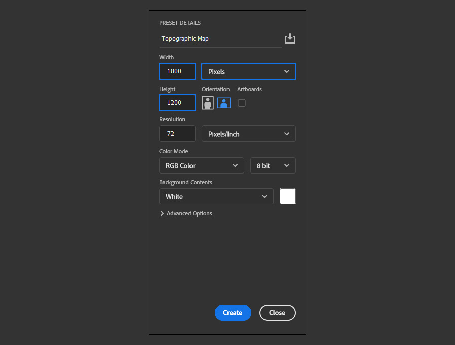
Step 1
Open Photoshop and make a new file at any size you want. In this case, I will make mine at 1800 x 1200 px.
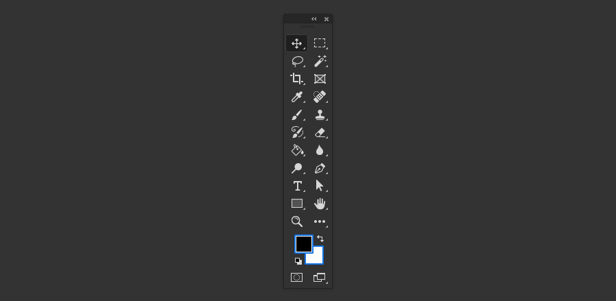
Step 2
Press "D" on your keyboard to reset the Foreground and Background colors.
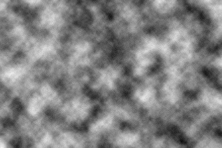
Step 3
Go to Filter > Render > Clouds.
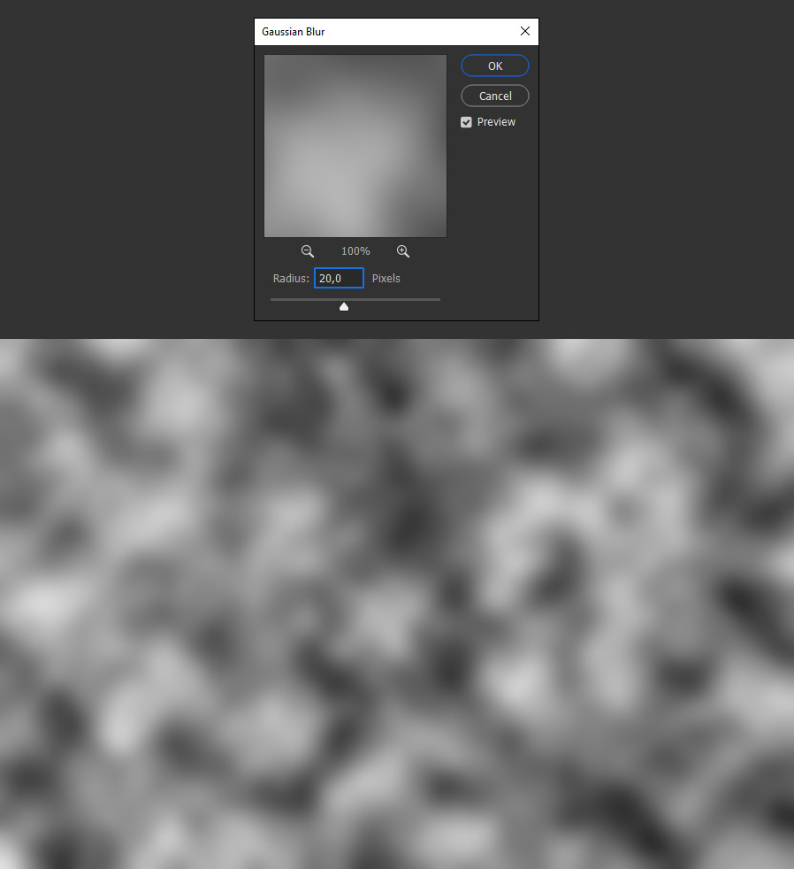
Step 4
Go to Filter > Blur > Gaussian Blur. Set the Radius to 20 px and click OK.
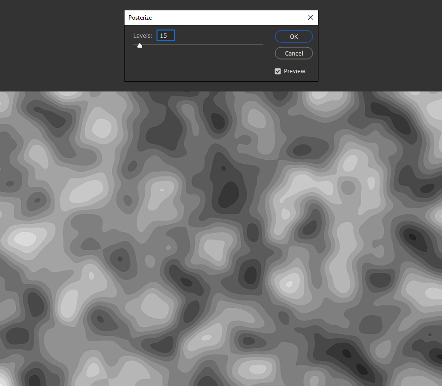
Step 5
Go to Image > Adjustments > Posterize. Set the Levels value to 15 and click OK.
Note: You may increase or decrease this value to get more or less contours on your final image.
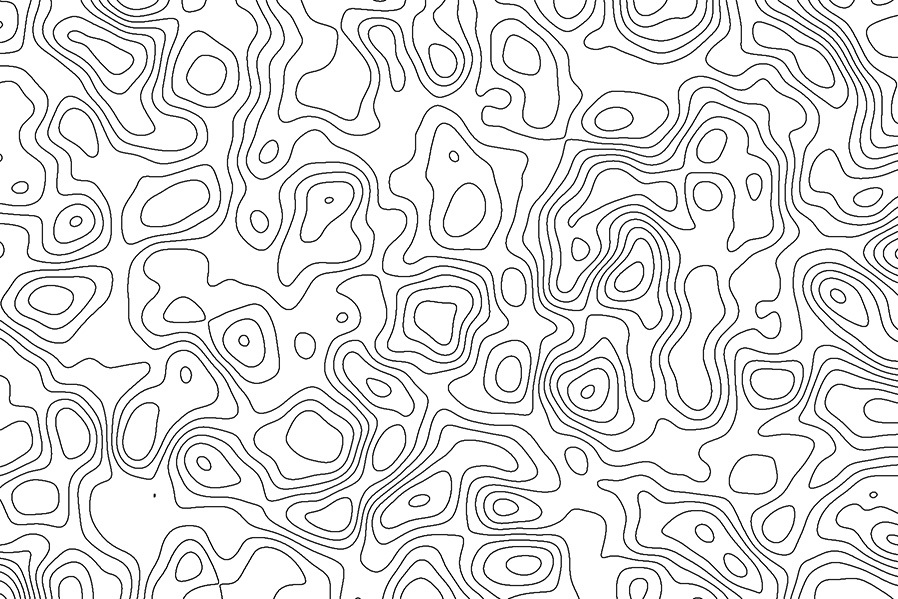
Step 6
Lastly, go to Filter > Stylize > Find Edges and save the image as .JPG on your computer.
Step 7
Open the saved image in Illustrator.
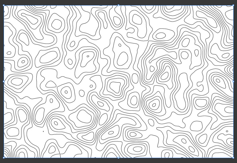
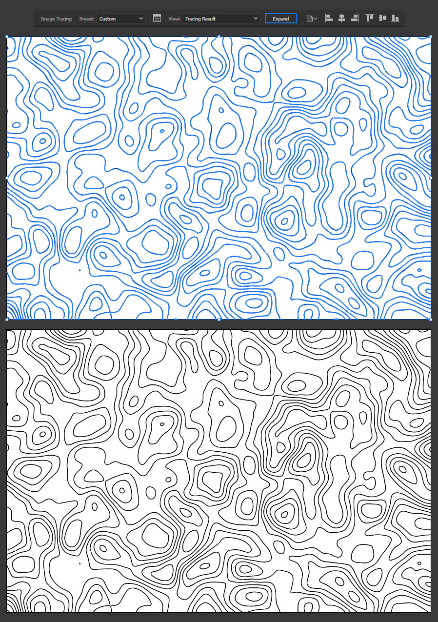
Step 8
With the image selected, go to Window > Image Trace and apply the following values.
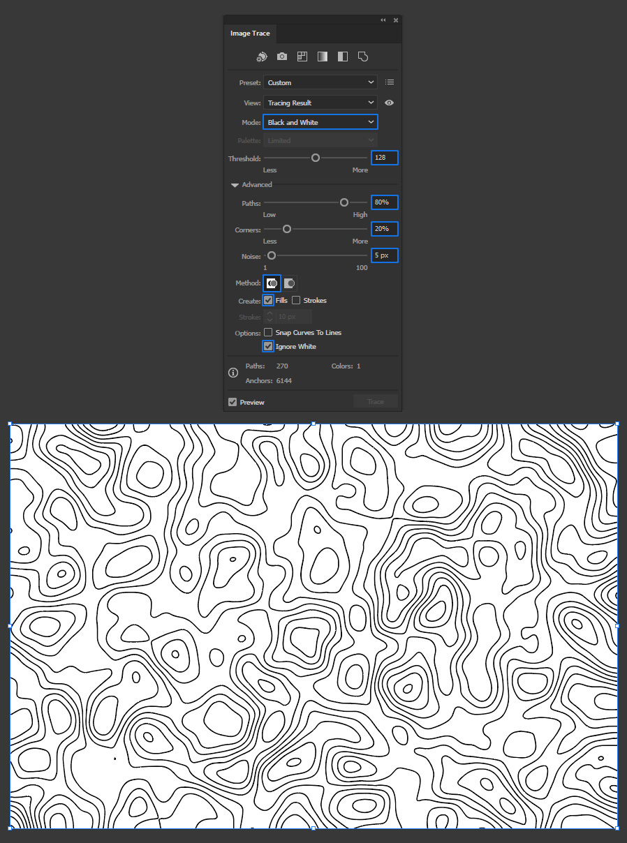
Step 9
Lastly, click the "Expand" button in the top toolbar.
A Final Note:
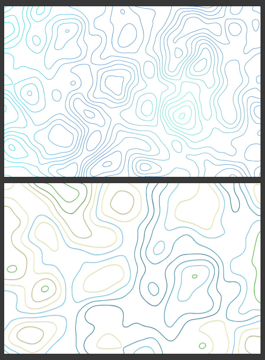
Now that you know how easily you can create topographic maps, you may now scale and colorize the map to your liking like you normally do in Illustrator and use it on a wide range of designs since it is now a vector shape.
More from Tutorials

How to Make Light Leaks From Images in Photoshop
Tutorialsby Diego Sanchez
Light leaks can instantly add warmth, depth, and a cinematic feel to your images, and creating them in Photoshop is much easier than you might think. In this tutorial, we’ll transform ordinary images into beautiful light leak overlays using just a few simple tools like Blur, Contrast adjustments, and the Liquify filter. By manipulating colors and shapes, you can craft soft gradients of light that bring a nostalgic, film-inspired atmosphere to your photos. Whether you want to enhance portraits, add flair to design projects, or create dreamy lighting effects, this method gives you full control over the final look in just a few minutes.
Read more
Enhance Autumn Colors in Lightroom with Ease
Tutorialsby Diego Sanchez
Enhancing the warm and vibrant tones of autumn photography is easier than it seems with just a few simple adjustments in Lightroom. By carefully refining exposure, boosting contrast, and enhancing the reds, oranges, and yellows, you can transform any fall image into a rich and captivating scene. Using only Lightroom’s basic tools along with the Color Mixer and Color Grading panels, you’ll bring out the full beauty of autumn landscapes with ease.
Read more
Easily Add a Twilight Mood to Your Photos in Lightroom
Tutorialsby Diego Sanchez
Give your photos a mystical touch by transforming ordinary daylight or sunset shots into captivating twilight scenes. By combining simple adjustments with precise tweaks in the Color Mixer, enhancing tones with Color Grading, and adding a delicate layer of Grain, it’s possible to achieve a soft, cinematic glow. These subtle yet impactful edits can shift the mood of your images, creating a serene, atmospheric look that feels like the perfect blue hour moment.
Read more
How to Create an Editable Soft Glow Text Effect in Illustrator
Tutorialsby Diego Sanchez
Creating eye-catching visual effects in Illustrator doesn’t always require complex tools or multiple layers. Sometimes, a single feature—used creatively—can deliver stunning results. Today, I’ll show you how to create a soft glow text effect using nothing but the Appearance Panel in Illustrator. Thanks to its non-destructive structure, you’ll be able to edit your text at any time without losing the effect, making it perfect for experimenting with different styles, colors, and typefaces without starting over.
Read more